


Brookline Precinct 13, Norfolk County, Massachusetts
About
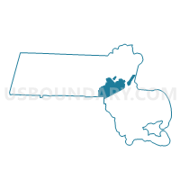
Outline

Summary
| Unique Area Identifier | 594982 |
| Name | Brookline Precinct 13 |
| County | Norfolk County |
| State | Massachusetts |
| Area (square miles) | 0.40 |
| Land Area (square miles) | 0.40 |
| Water Area (square miles) | 0.00 |
| % of Land Area | 100.00 |
| % of Water Area | 0.00 |
| Latitude of the Internal Point | 42.33268060 |
| Longtitude of the Internal Point | -71.15009020 |
Maps


Graphs
Select a template below for downloading or customizing gragh for Brookline Precinct 13, Norfolk County, Massachusetts


Neighbors
Neighoring Voting District (by Name) Neighboring Voting District on the Map
- Boston Ward 21 Precinct 10, Suffolk County, MA
- Boston Ward 21 Precinct 12, Suffolk County, MA
- Boston Ward 21 Precinct 14, Suffolk County, MA
- Boston Ward 21 Precinct 16, Suffolk County, MA
- Brookline Precinct 10, Norfolk County, MA
- Brookline Precinct 11, Norfolk County, MA
- Brookline Precinct 12, Norfolk County, MA
- Brookline Precinct 14, Norfolk County, MA
- Brookline Precinct 15, Norfolk County, MA
- Newton Ward 7 Precinct 1, Middlesex County, MA
Top 10 Neighboring County Subdivision (by Population) Neighboring County Subdivision on the Map
- Boston city, Suffolk County, MA (617,594)
- Newton city, Middlesex County, MA (85,146)
- Brookline town, Norfolk County, MA (58,732)
Top 10 Neighboring Place (by Population) Neighboring Place on the Map
Top 10 Neighboring Unified School District (by Population) Neighboring Unified School District on the Map
- Boston School District, MA (617,594)
- Newton School District, MA (85,146)
- Brookline School District, MA (58,732)
Top 10 Neighboring State Legislative District Lower Chamber (by Population) Neighboring State Legislative District Lower Chamber on the Map
- Eighteenth Suffolk District, MA (44,171)
- Tenth Suffolk District, MA (42,147)
- Fifteenth Norfolk District, MA (39,127)
- Twelfth Middlesex District, MA (38,706)
- Seventeenth Suffolk District, MA (37,756)
Top 10 Neighboring State Legislative District Upper Chamber (by Population) Neighboring State Legislative District Upper Chamber on the Map
Top 10 Neighboring 111th Congressional District (by Population) Neighboring 111th Congressional District on the Map
Top 10 Neighboring Census Tract (by Population) Neighboring Census Tract on the Map
- Census Tract 4012, Norfolk County, MA (7,031)
- Census Tract 5.02, Suffolk County, MA (6,303)
- Census Tract 3736, Middlesex County, MA (6,026)
- Census Tract 4004, Norfolk County, MA (5,449)
- Census Tract 4006, Norfolk County, MA (5,177)
- Census Tract 4005, Norfolk County, MA (5,173)
- Census Tract 5.04, Suffolk County, MA (4,985)
- Census Tract 4011, Norfolk County, MA (4,441)